Sugar Pine and Bobcat Point Trails Loop in Sequoia National Park
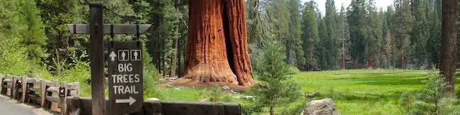
Isn't it comforting to know that even in the Giant Forest, the most visited area of Sequoia National Park, you can still find a wonderful trail where you might not bump into another hiker? Starting from the busy parking area at Crescent Meadow, Sugar Pine Trail heads away from that beautiful sequoia-lined meadow to seek out other interesting natural features away from the big trees. ...Read more.
Tagged with · Giant Forest · Morteros · National Parks
Distance: 1.5 miles · Elevation change: 250 feet
By: Published: June 2, 2013 Last updated: April 6, 2026
Big Trees Trail in Sequoia National Park
Big Trees Trail offers an easy, educational, and beautiful hike through giant sequoias in Sequoia National Park's Giant Forest. Big Trees Trail is a level and paved nature trail circling 0.8 miles beneath towering sequoias along the edges of Round Meadow. Handicapped visitors can park at a convenient lot near Round Meadow for a 1-mile wheelchair-friendly hike. ...Read more.
Distance: 1.4 miles · Elevation change: 50 feet
By: Published: May 31, 2013 Last updated: December 5, 2025
Hanging Rock in Sequoia National Park
Hanging Rock Trail might be one of the easiest trails to overlook in Sequoia National Park, but there are many reasons why you shouldn't. To start with, you'll find a fun giant sequoia at the trailhead that has been burned out like a chimney with two gaps big enough to climb in and out of. The hike to Hanging Rock also has some of the park's best views of Moro Rock, Sequoia's most famous granite dome. ...Read more.
Tagged with · Giant Forest · National Parks
Distance: 0.35 miles · Elevation change: 100 feet
By: Published: May 30, 2013 Last updated: December 5, 2025
Mount Pickering in Sequoia National Park
Mount Pickering rises to 13,485 feet and offers fine views over the Sierra. While not tall enough to be called a 14er, this 13er offers great views of two of those exclusive peaks, Mount Whitney and Mount Langley, as well as several other high peaks. This remote mountain is located west of the Sierra Crest in the Whitney Region of Sequoia National Park. ...Read more.
Distance: 30 miles · Elevation change: 3500 feet
By: Published: October 29, 2010 Last updated: April 19, 2026
Primrose Lake in Sequoia National Park
If you are hiking to Sky Blue Lake in the high mountain backcountry of Sequoia National Park, There are nearby lakes worth visiting. Primrose Lake, is located just off the side of Miter Basin and is a scenic destination. To get to Primrose Lake, follow Upper Rock Creek to Miter Basin. Pass the Major General on the right and turn left up the last cirque before the ridge that separates Primrose Lake from Sky Blue Lake at the top of the basin (see the map below for a visual explanation). ...Read more.
Distance: 28 miles · Elevation change: 2350 feet
By: Published: October 28, 2010 Last updated: December 5, 2025
Upper Rock Creek to Sky Blue Lake in Sequoia National Park
A remote and picturesque basin on the west side of Sequoia National Park rises to a large lake with waters so deep and blue you will think you are staring up at the heavens. The trek up Miter Basin begins at Rock Creek Meadow, nine miles from the nearest trailhead. Those making the hike typically stay overnight in the area, and nearby Lower Soldier Lake offers great camping for backpackers. ...Read more.
Distance: 26 miles · Elevation change: 2350 feet
By: Published: October 26, 2010 Last updated: December 5, 2025
Lower Soldier Lake to New Army Pass in Sequoia National Park
New Army Pass lies at the end of Cottonwood Lakes Trail, 7.5 miles from Horseshoe Meadow. The pass provides off-trail ascents to two nearby summits, Mount Langley and Cirque Peak. A trail down the northwest side of the pass ventures into Sequoia National Park with access to countless backcountry destinations including Lower Soldier Lake, Sky Blue Lake, and Mount Pickering. ...Read more.
Distance: 19.2 miles · Elevation change: 2300 feet
By: Published: October 12, 2010 Last updated: April 9, 2026
Lower Soldier Lake in Sequoia National Park
Lower Soldier Lake lies at 10,800 feet on the eastern edge of Sequoia National Park. This is a favored place for backpackers to bed down, and for good reason. A host of trails and off-trail targets make this a prime base camp. The nearest trailhead is Horseshoe Meadow in the Golden Trout Wilderness, which offers two routes to Lower Soldier Lake. About half a mile separates the start of the two trails so they can easily be combined to form a loop. ...Read more.
Distance: 19.2 miles · Elevation change: 2350 feet
By: Published: October 10, 2010 Last updated: December 5, 2025
Mount Langley in Sequoia National Park
Rising to 14,042 feet, Mount Langley is less than five hundred feet shorter than Mount Whitney but receives far fewer visitors. While the lottery to get a permit for Mount Whitney can be challenging and competitive, Mount Langley's hikers can easily get a free permit on the day of their hike. The summit provides expansive views, solitude, and a deep feeling of accomplishment. ...Read more.
Distance: 22 miles · Elevation change: 4000 feet
By: Published: September 21, 2010 Last updated: December 9, 2025
Monarch Lakes in Sequoia National Park
The beautiful Monarch Lakes grace the Sierra in an alpine cradle beneath Sawtooth Peak in the Mineral King Region of Sequoia National Park. A 9.4-mile round trip hike climbs over 2,500 feet to visit the picturesque pair of high-elevation lakes. Make your way to the Sawtooth Trailhead near the end of Mineral King and start up the trail. The first 0. ...Read more.
Tagged with · Lakes · National Parks
Distance: 9.4 miles · Elevation change: 2500 feet
By: Published: April 27, 2010 Last updated: December 5, 2025