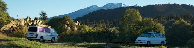
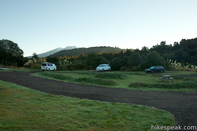
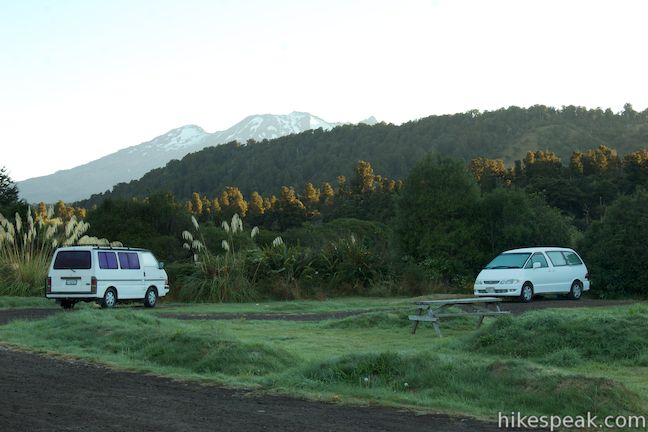
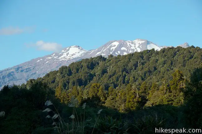
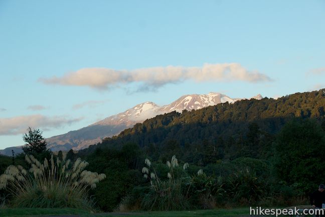
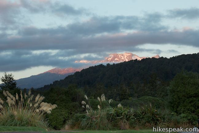
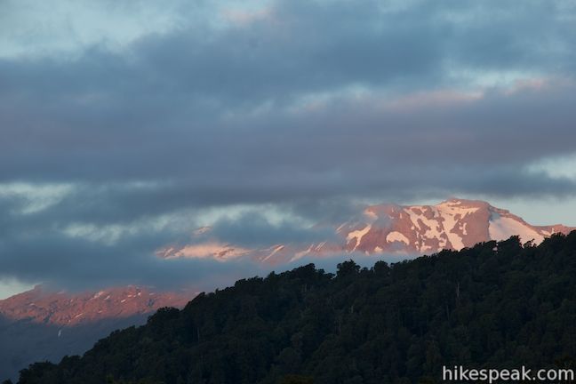
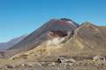
For camping on the south side of Tongariro National Park, check out Mangawhero Campsite. This campground near the town of Ohakuna has twelve sites spread over two loops and offers views of Mount Ruapehu, which looks stunning from the campground at sunrise and sunset.
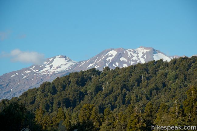
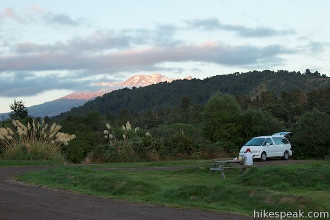
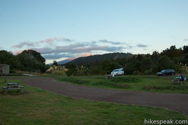
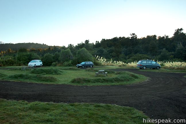
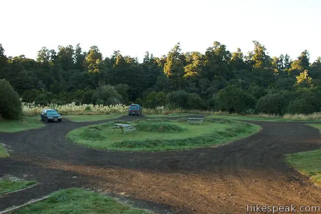
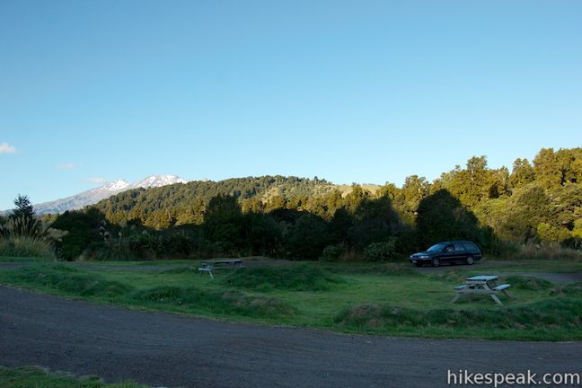
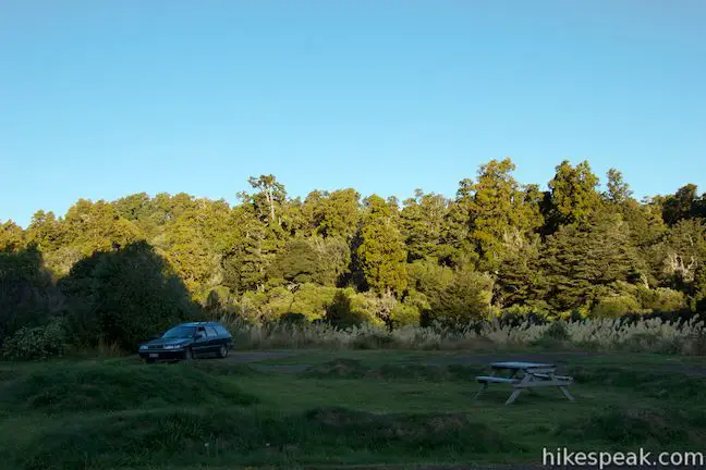
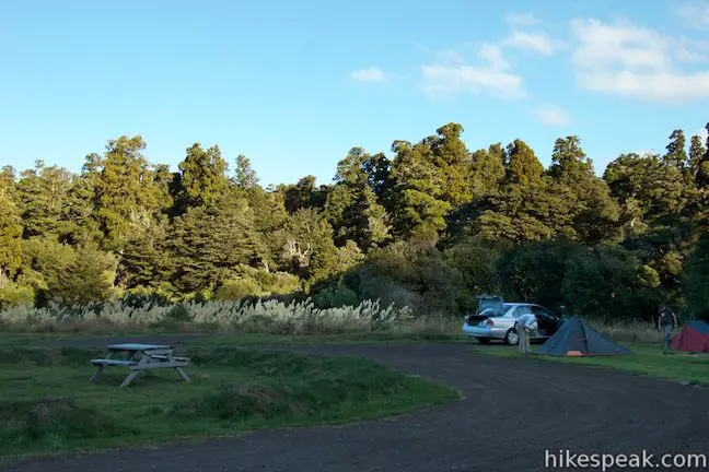
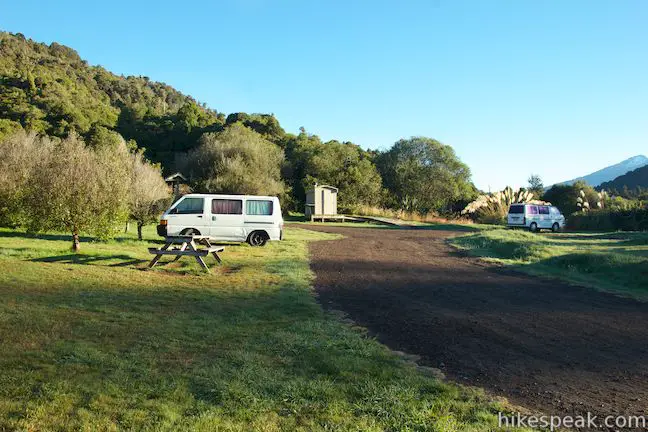
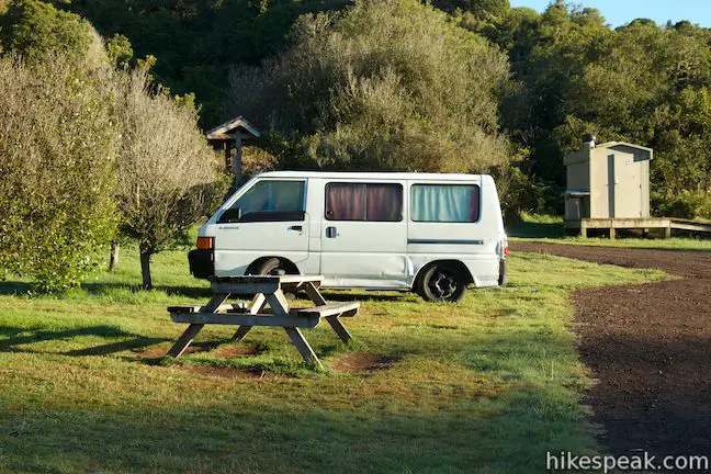
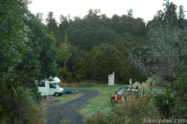
Mangawhero Campground is a standard Department of Conservation campsite with twelve sites suitable for tents and campervans. The road to the campground is narrow and turns to gravel, so it is not a good option for long RVs. The grassy tent sites are well spaced on two separate loops. The first loop has the better views of Mount Ruapehu, which towers above the campground to the north. Mount Ruapehu is the tallest mountain on the North Island of New Zealand and the national’s largest active volcano. The dark snow-covered mountain puts on a lovely rosy color at sunrise and sunset for campers to enjoy.
There are basic toilets by both loops of Mangawhero Campground. The first loop also has a sink with running water for brushing your teeth and washing dishes. There are water spigots at the campground, and while the water is generally safe to drink, the Department of Conservation recommends that you treat the water first by boiling it. There are picnic tables spread out around the campground, making it easy to enjoy meals while taking in views of Mount Ruapehu.
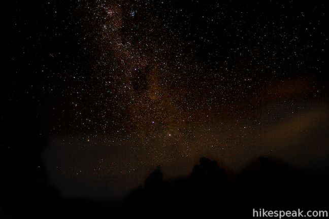
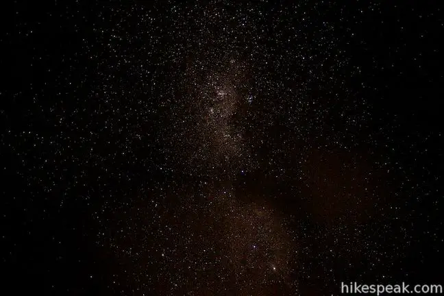
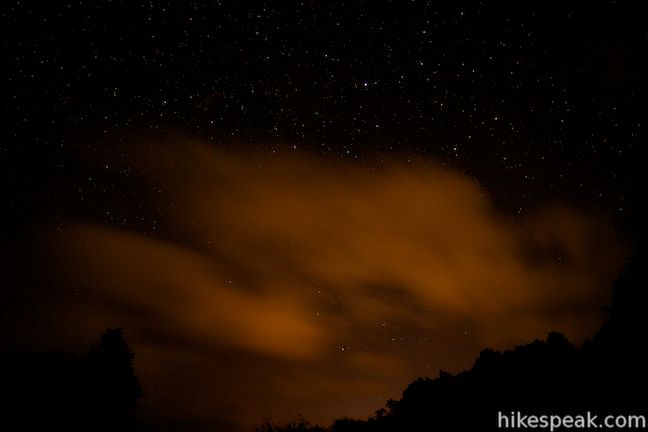
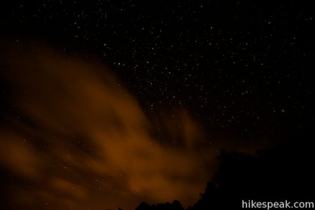
The sound of the Mangawhero River will serenade you to sleep at night, but if you stay up after dark, you’ll be treated with great stargazing (photos below).
There is a fee of $13 per person per night to camp at Mangawhero Campground. Children under fifteen are $6.50 per night and young children under the age of five are free (All prices in New Zealand Dollars as of 2018). The campground is first-come first-serve and does not take reservations. There are camp fee envelopes at the campground entrance, so that you can deposit what’s owed. Bring exact change or write a check payable to the Department of Conservation. Dogs are not allowed at the campground. Campfires are also not allowed, but you can use a gas stove. At an elevation just below 700 meters, you can expect colder evenings in the spring and fall. There is no trash collection at the campground, so pack out your rubbish.
Directions: Take State Highway 49 to the center of Ohakune and turn north up Goldfinch Street, which is directly across from the i-SITE. Drive 1.1 kilometers and continue onto Mangawhero Terrace. After 1.2 kilometers, cross Old Station Road, pass under railroad tracks, and continue north up Ohakune Mountain Road. After 1.5 kilometers, bear left onto a side road following signs for Mangawhero Campsite. Cross the Mangawhero River and drive 300 meters to the first campground loop (on the right) or 450 meters to the second campground loop.
Campground address: Ohakune Mountain Road, Tongariro National Park, Manawatu-Wanganui, 4691, New Zealand
Campground coordinates: -39.391993, 175.429671 (39° 23′ 31.17″S 175° 25′ 46.81″E)
Use the map below to get directions to the campground:
Or view New Zealand tracks, campgrounds, and lodging in a larger map


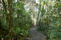 | Rimu Walk This short, level walk explores a Rimu forest along the Mangawhero River near the town of Ohakune at the south end of Tongariro National Park. |
 | Waitonga Falls This 4-kilometer return hike reaches Tongariro National Park’s tallest waterfall and passes through an alpine wetland that reflect views of Mount Ruapehu. |
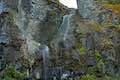
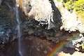 | Mangawhero Falls This easy 0.3-kilometer hike leads to a viewpoint for a 25-meter tall waterfall below Mount Ruapehu in Tongariro National Park. |
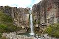 | Taranaki Falls This 6.45-kilometer loop crosses a variety of volcano-influenced landscapes to reach a beautiful 20-meter tall waterfall in Tongariro National Park. |
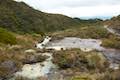 | Silica Rapids This 5.15-kilometer point-to-point hike or 7.15 kilometer loop leaves from Whakapapa Village in Tongariro National Park and crosses alpine bogs, forests, streams, and ridges of volcanic rock to reach creamy cascades on silica terraces. |
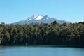 | Lake Rotokura This 2-kilometer return hike reaches a peaceful blue lake that reflects a view of Mount Ruapehu, the tallest mountain in the North Island. |
 | Tawhai Falls This 0.8-kilometer return hike visits a short but enticing single-drop waterfall near Whakapapa Village in Tongariro National Park. |
 | Tongariro Alpine Crossing This 19.4-kilometer long through-hike ventures across dynamic volcanic landscapes in Tongariro National Park and ranks among the world’s greatest day hikes. |
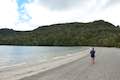 | Lake Rotopounamu This 6.4-kilometer loop visits tranquil beaches on a forest-wrapped lake in Tongariro National Park. |
 | More trails in New Zealand Explore other destinations for walking and hiking (as well camping and lodging) in New Zealand. |