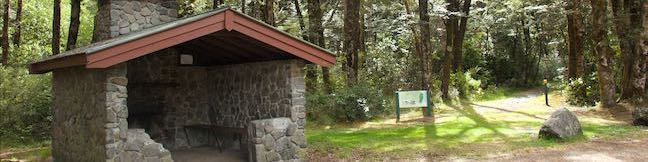
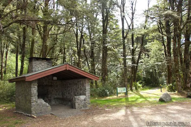
Greynes Shelter Campground is a free, almost-no-frills campground located three kilometers from Arthur’s Pass Village. The campground has an open grassy area and a small stone shelter with three walls, benches, and a fireplace. The campground’s other amenity is a toilet. Old Coach Road Walk starts and ends at the campground, providing campers an easy activity.
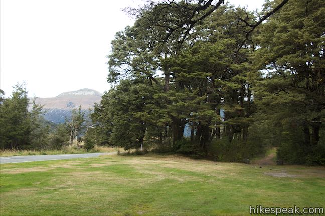
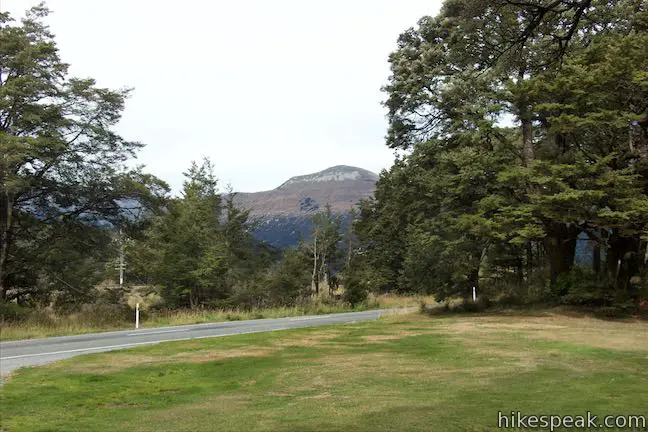
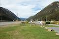
Greynes Shelter Campground consists of a lawn surrounding a semi-circular gravel driveway off State Highway 73, the road into Arthur’s Pass Village from Canterbury. While the campsites are not numbered, the lawn has room for around 10 parties. Set up a tent or a campervan along the dirt driveway or against the encompassing line of trees.
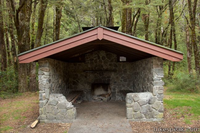
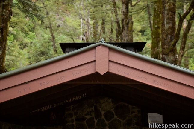
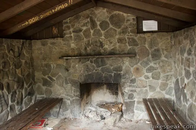
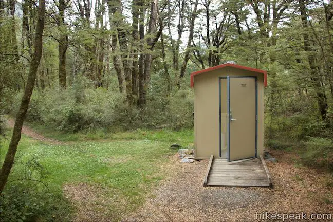
Greyneys Shelter is open in the front, inviting you to walk right in. Benches line the side walls, which are made of stone. The back of the shelter has a fireplace that campers can use to stay warm on cold evenings. North of the shelter (to the right as you face it) is one end of Old Coach Road Walk, which visits a century old roadbed in the forest above the campground. Go a couple meters up this track to find the campground toilet.
While staying at the campground, you will not be able to escape the noise of traffic on the road that passes next to the camping area. Less frequent but louder are the trains that use the rail line on the other side of the road, making multiple trips each day through Arthur’s Pass National Park.
Drinking water is not available at the Greynes Shelter Campground. Please remove your rubbish as garbage is not collected at the campground. Dogs are not permitted in the campground or on hiking tracks in Arthur’s Pass National Park. On a more positive note, the campground is free! You will not have to pay a fee to enter the national park or camp at Greynes Shelter Campground.
Directions: From Sheffield (which is just over 50 kilometers west of Christchurch), take State Highway 73 northwest for 86.3 kilometers (27.5 kilometers past Lake Pearson / Moana Rua Wildlife Refuge) to find a turnout for the campground on the left. From Greymouth, on the west coast, drive south on State Highway 6 for 17 kilometers to Kumara Junction. Turn inland on SH 73 and drive 83.4 kilometers southeast to find the camping area on the right, 6 kilometers past Arthur’s Pass Village.
Campground address: State Highway 73, Arthur’s Pass Village, Canterbury, 7875, New Zealand
Campground coordinates: -42.9843, 171.5906 (42° 59′ 03.47″S 171° 35′ 26.15″E)
Use the map below to get directions to the campground:
Or viewNew Zealand tracks, campgrounds, and lodging in a larger map


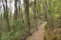 | Old Coach Road Walk If you stay overnight at Greyneys Shelter Campground, start the day with this 1 to 1.4-kilometer loop that leaves the campground and travels through the surrounding forest along an old roadbed. |
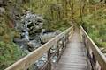
 | Millennium Walk to Avalanche Creek Waterfall This 500-meter round trip walk goes from Arthur’s Pass National Park Visitor Centre to a bridge and viewpoint below a waterfall on Avalanche Creek as it approaches Arthur’s Pass Village. |
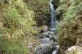
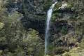
 | Devils Punchbowl Falls This 2-kilometer round trip hike ascends to a viewing platform near the base of an impressive waterfall that should be a top priority for Arthur’s Pass National Park visitors. |
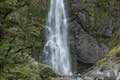
 | Arthur’s Pass Village to Bridal Veil Falls Lookout This 1.8 kilometer round trip hike up Arthur’s Pass Walking Track takes a gradual approach to a viewpoint with a perspective of Bridal Veil Falls and surrounding mountains. |
 | Jacks Hut to Bridal Veil Falls Lookout This 2.5-kilometer round trip hike on Arthur’s Pass Walking Track crosses beech forests and alpine shrublands, dropping across a canyon to arrive at a view of Bridal Veil Falls. |
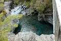 | Bealey Chasm Walk This short walk passes through moss-covered beech trees to a bridge over Bealey River where it slips through a ravine. |
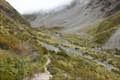 | Otira Valley Track This 3.8-kilometer round trip hike ventures up a valley on the north side of Arthur’s Pass, finding a footbridge over Otira River and broad views of surrounding mountains. |
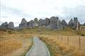 | Kura Tawhiti / Castle Hill Conservation Area This 2 to 3-kilometer hike explores a fascinating jumble of limestone boulders close to Arthur’s Pass National Park. |
 | More trails in New Zealand Explore other destinations for walking and hiking (as well camping and lodging) in New Zealand. |
 | Avalanche Creek Shelter Campground This 10-site campground in Arthur’s Pass Village has a large shelter and easy access to the park visitor center and nearby hiking tracks. |
 | Lake Pearson (Moana Rua) Campground This campground has about 20 sites along the shore of a peaceful lake between mountains in the Canterbury Region near Arthur’s Pass National Park. |
The Department of Conservation webpage for Greyneys Shelter Campground
Greyneys Shelter Campground on sites.google.com
Arthur’s Pass National Park on wikipedia.org
Arthur’s Pass National Park on newzealand.com
The Department of Conservation brochure for Arthur’s Pass National Park
The Department of Conservation webpage for Arthur’s Pass National Park