If you are visiting Arches or Canyonlands and are planning to camp, you should know that camping within these national parks is quite limited. Fortunately, the Bureau of Land Management operates over two dozen developed campgrounds (with over 400 individual sites) outside these parks around the city of Moab.
Each of the BLM campgrounds are first-come first-serve, so it is best to arrive early and plan ahead. Outside of the busiest weekends, the camping is quite ample. Fees for each site are $20 per night.
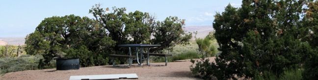
Most BLM campgrounds are more primitive than what you would usually find at a national park. Drinking water and garbage receptacles are not always available, and the restrooms at the smaller campgrounds are quite rustic. Each site has a picnic table and fire ring.
The Moab Field Office of the Bureau of Land Management previously published a Moab camping webpage that had lots of information about the BLM campgrounds around Moab (Some of that information is now out-of-date). The current website for the Moab Field Office is short on camping information, so the best thing to do is call (435) 259-2100 or email blm_ut_mb_mail@blm.gov for up-to-date details.
BLM Campgrounds around Moab, Utah
This list provides information about the Bureau of Land Management campgrounds in the Moab area. The campgrounds are grouped by the main road that they are either on or adjacent to. The locations of these camping areas are also displayed on the map below.
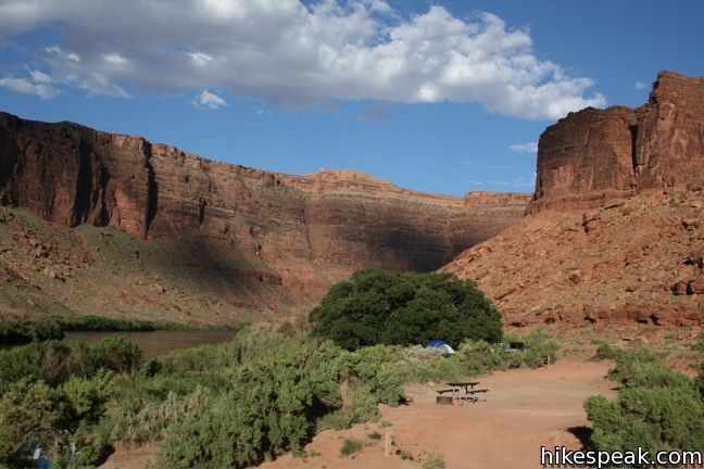
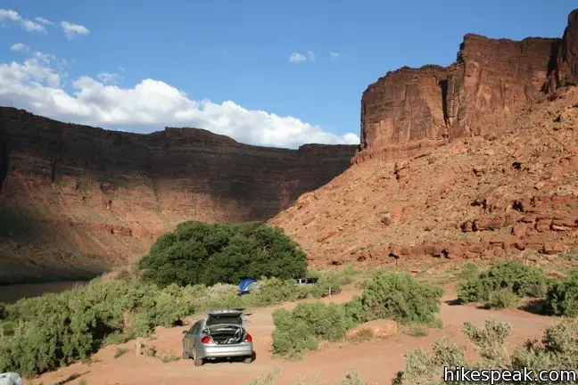
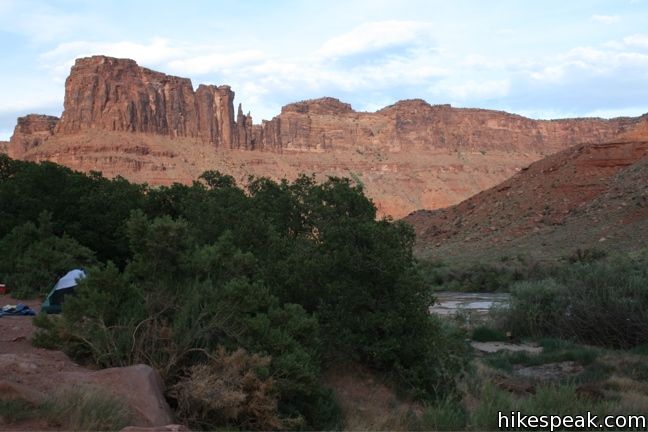
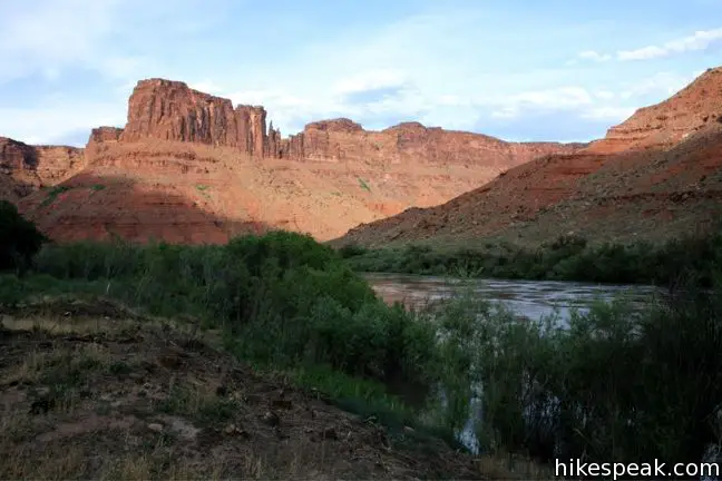
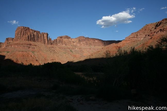
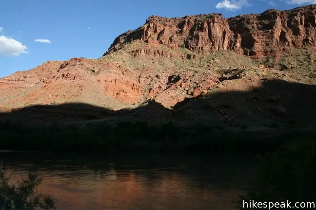
Campgrounds along Highway 128 (northeast of Moab)
Dewey Bridge Campground | 7 sites and 3 group sites | open year round | first-come first-serve | $20 per night | located near mile post 29 on Highway 128 | coordinates: 38.81045,-109.30756 | vault toilet, picnic tables, and fire rings (no water) | elevation 4,100 feet
Hittle Bottom Campground | 15 sites | open year round | first-come first-serve | $20 per night | located near mile post 23 on Highway 128 | coordinates: 38.75918,-109.32403 | vault toilet, picnic tables, and fire rings (no water) | elevation 4,100 feet
Lower Onion Creek Campground | 21 sites and 1 group site | open year round | first-come first-serve | $20 per night | located near mile post 22 on Highway 128 | coordinates: 38.73742,-109.36039 | vault toilet, picnic tables, and fire rings (no water) | elevation 4,080 feet
Fisher Towers Campground | 5 sites | open year round | first-come first-serve | $20 per night | located near mile post 22 on Highway 128 | coordinates: 38.72512,-109.30941 | vault toilet, picnic tables, and fire rings (no water) | elevation 4,060 feet
Upper Onion Creek Campground | 14 sites and 2 group sites | open year round | first-come first-serve | $20 per night | located near mile post 21 on Highway 128 | coordinates: 38.72222,-109.34494 | vault toilet, picnic tables, and fire rings (no water) | elevation 4,200 feet
Upper Big Bend Campground | 8 sites | open year round | first-come first-serve | $20 per night | located near mile post 9 on Highway 128 | coordinates: 38.64930,-109.48836 | vault toilet, picnic tables, and fire rings (no water) | elevation 4,000 feet
Big Bend Campground | 23 sites and 3 group sites | open year round | first-come first-serve | $20 per night | located near mile post 8 on Highway 128 | coordinates: 38.64881,-109.47981 | vault toilet, picnic tables, and fire rings (no water) | elevation 4,000 feet
Oak Grove Campground | 7 sites | open year round | first-come first-serve | $20 per night | located near mile post 7 on Highway 128 | coordinates: 38.64421,-109.47617 | vault toilet, picnic tables, and fire rings (no water) | elevation 4,000 feet
Hal Canyon Campground | 11 sites | open year round | first-come first-serve | $20 per night | located near mile post 7 on Highway 128 | coordinates: 38.64172,-109.47655 | vault toilet, picnic tables, and fire rings (no water) | elevation 4,100 feet | elevation 4,010 feet
Drinks Canyon Campground | 17 sites | open year round | first-come first-serve | $20 per night | located near mile post 6 on Highway 128 | coordinates: 38.63432,-109.48387 | vault toilet, picnic tables, and fire rings (no water) | elevation 4,000 feet
Grandstaff Campground | 16 sites | open year round | first-come first-serve | $20 per night | located near mile post 3 on Highway 128 | coordinates: 38.61353,-109.53091 | vault toilet, picnic tables, and fire rings (no water) | elevation 3,975 feet
Goose Island Campground | 18 sites and 2 group sites | open year round | first-come first-serve | $20 per night | located near mile post 2 on Highway 128 | coordinates: 38.60965,-109.55757 | vault toilet, picnic tables, and fire rings (no water) | elevation 3,975 feet
Rock Castle Campground | 4 sites | open year round | first-come first-serve | $20 per night | located in Castle Valley off La Sal Loop Road, 11 miles up from Highway 128 | coordinates: 38.59922,-109.29071 | vault toilet, picnic tables, and fire rings (no water) | elevation 6,375 feet
Campgrounds along Highway 313
Horsethief Campground | 55 sites and 1 group site | open year round | first-come first-serve | $20 per night | located 12 miles from Highway 191 on U-313 | coordinates: 38.58401,-109.81425 | vault toilet, picnic tables, and fire rings (no water) | elevation 5,825 feet
Cowboy Camp Campground | 7 sites | open year round | first-come first-serve | $20 per night | located 18 miles from Highway 191 on U-313 | coordinates: 38.56183,-109.79615 | vault toilet, picnic tables, and fire rings (no water) | elevation 6,130 feet
Lone Mesa Campground | 5 group sites | open year round | reservations accepted | located 9 miles from Highway 191 on U-313 | coordinates: 38.63625,-109.80411 | vault toilet, picnic tables, and fire rings (no water) | elevation 5,400 feet
Campgrounds along Highway 279 (west of Moab)
Goldbar Campground | 5 campsites and 4 group sites | open year round | first-come first-serve | $20 per night | located 10 miles from Highway 191 on U-279 | coordinates: 38.57638,-109.63419 | vault toilet, picnic tables, and fire rings (no water) | elevation 3,960 feet
Williams Bottom Campground | 17 sites | open year round | first-come first-serve | $20 per night | located 6 miles from Highway 191 on U-279 | coordinates: 38.53804,-109.60399 | vault toilet, picnic tables, and fire rings (no water) | elevation 3,975 feet
Jaycee Park Campground | 7 sites | open year round | first-come first-serve | $20 per night | located 4.2 miles from Highway 191 on U-279 | coordinates: 38.55646,-109.59038 | vault toilet, picnic tables, and fire rings (no water) | elevation 3,975 feet
Campgrounds along Kane Creek Road (west of Moab)
Kings Bottom Campground | 21 sites | open year round | first-come first-serve | $20 per night | located 2.8 miles from Highway 191 on Kane Creek Road | coordinates: 38.55648,-109.58499 | vault toilet, picnic tables, and fire rings (no water) | elevation 3,975 feet
Moonflower Group Campground | 1 group site | open year round | first-come first-serve | no fee | located 3 miles from Highway 191 on Kane Creek Road | coordinates: 38.55419,-109.58718 | vault toilet, picnic tables, and fire rings (no water) | elevation 3,965 feet
Hunter Canyon Campground | 7 sites | open year round | first-come first-serve | $20 per night | located 7.8 miles from Highway 191 on Kane Creek Road | coordinates: 38.50983,-109.59711 | vault toilet, picnic tables, and fire rings (no water) | elevation 4,075 feet
The Ledge Campground | 31 sites and 2 group sites | open year round | first-come first-serve | $20 per night | located 12 miles from Highway 191 on Kane Creek Road | coordinates: 38.48496,-109.60467 | vault toilet, picnic tables, and fire rings (no water) | elevation 4,150 feet
Campground along Highway 191 (south of Moab)
Ken’s Lake Campground | 47 sites and 2 group sites | open year round | first-come first-serve | $20 per night | located 1 mile from Highway 191 off Flat Pass Road (Steelbender Safari Route) | 10 miles south of Moab | coordinates: 38.47661,-109.42241 | vault toilet, picnic tables, and fire rings (no water) | elevation 5,090 feet
Campground along Highway 191 (north of Moab)
Courthouse Rock Campground | 10 campsites | open year round | first-come first-serve | $20 per night | 16 miles from Moab | located along Mill Canyon Road, one mile off Highway 191 | coordinates: 38.72016,-109.73408 | vault toilet, picnic tables, and fire rings (no water) | elevation 4,500 feet
Campgrounds in Canyon Rim Recreation Area (south of Moab)
Hatch Point Campground | 10 sites | open year round | first-come first-serve | $20 per night | located off U-132 (Hatch Point Road) | 56 miles south and west of Moab | coordinates: 38.38081,-109.61674 | vault toilet, picnic tables, and fire rings | drinking water available from mid-April through September | elevation 5,800 feet
Windwhistle Campground | 15 sites and 1 group site | open year round | first-come first-serve | first-come first-serve | $20 per night | located on Wind Whistle Campground road off U-133 (Needles Overlook Road) | 38 miles south of Moab | coordinates: 38.17750,-109.46218 | vault toilet, picnic tables, and fire rings | drinking water available from mid-April through September | elevation 5,990 feet
Points Beyond (north of Moab)
Swasey’s Rapid Campground | 15 sites and 1 group site | open year round | first-come first-serve | $20 per night | located on the Green River along Hastings Road | coordinates: 39.11613,-110.11017 | vault toilet, picnic tables, and fire rings (no water) | elevation 4,100 feet
Westwater Campground | 15 sites | open year round | first-come first-serve | $20 per night | located at the Westwater Ranger Station on BLM Road 191 | coordinates: 39.08703,-109.10203 | vault toilet, picnic tables, and fire rings (no water) | elevation 4,320 feet
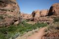
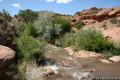 | Mill Creek This half-mile hike visits a swimming hole that offers refreshing escape from Utah’s summer scorchers. |
 | Grandstaff Trail to Morning Glory Bridge This 4.65-mile round trip hike travels through a scenic canyon to a 243-foot long natural bridge. |
 | More trails in Utah Explore other hikes in Zion, Canyonlands, and Arches National Parks. |
[…] and near Moab. You can also try camping at Arches National Park! You can find a list of available free campgrounds in Moab […]
How long can i stay on one spot? Thank you.