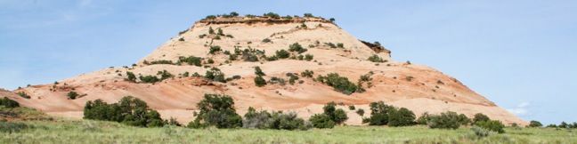
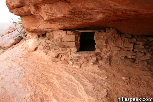
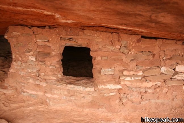
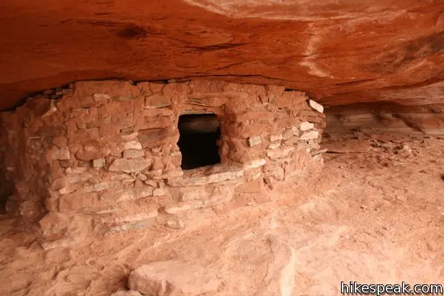
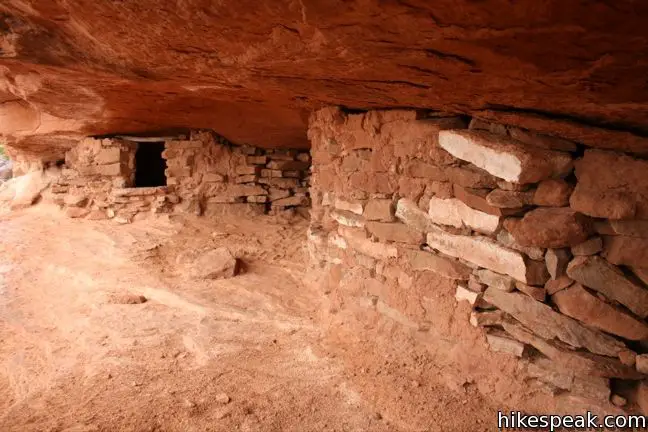
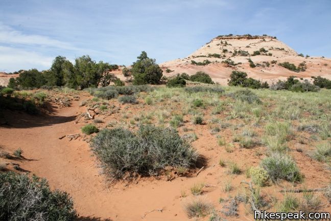
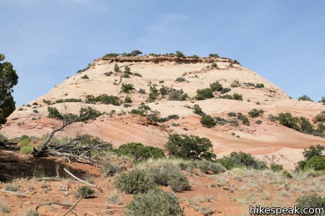
Aztec Butte is one of the more unique hikes in the Island in the Sky region of Canyonlands National Park. The trail crosses level grasslands and climbs a steep slope to a dome-shaped butte rising above the mesa. Alcoves along the rim of the butte house Puebloan granaries, which early inhabitants used for storage. A loop around the top of Aztec Butte visits two such granaries and provides excellent views into Taylor Canyon. A spur trail loops around a shorter butte with another well-preserved granary. This is a 1.8-mile round hike including the second butte, and a 1.3-mile hike without.
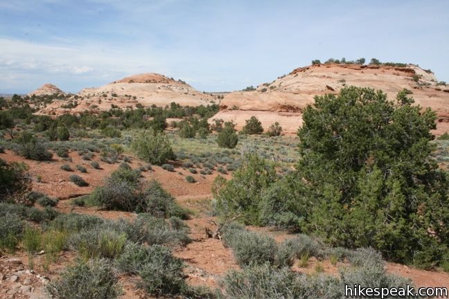
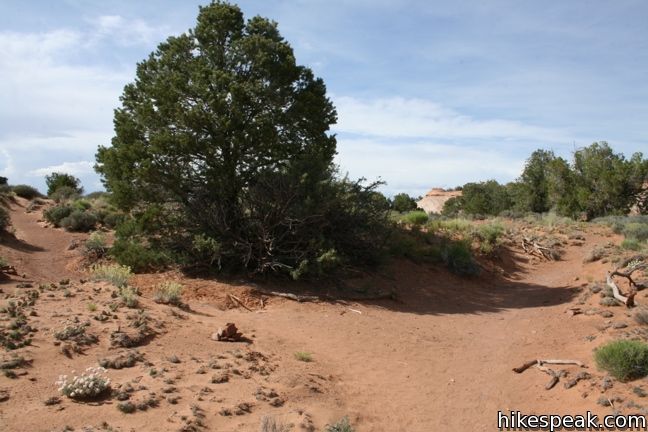
From the trailhead, drop down across grasslands and begin hiking up a small wash. After a quarter mile, the single track turns left, exiting the wash on an almost direct line for Aztec Butte.
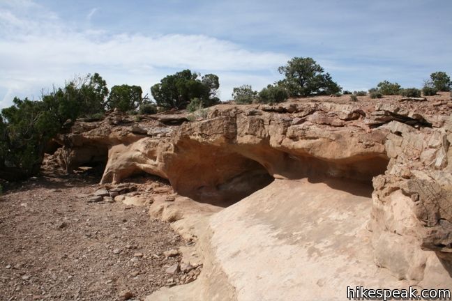
A junction comes shortly thereafter. To the left, a spur ascends 90 feet up a short butte. Follow the cairns as the path drops just below the rim of the butte to visit a granary at the top of the northern slope. Wrap around the butte as the track circles back to the main trail, forming a half-mile addition.

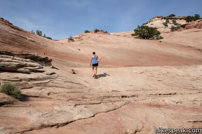
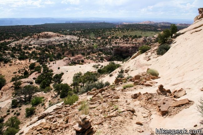
The principal trail continues to the base of Aztec Butte, where it becomes suddenly steep, rapidly ascending 165 feet. The path up the sandstone slope is tricky to follow, and a bit of improvisation is required. Persevere up and to the right, to a point where cairns escort you over the top of the rim.
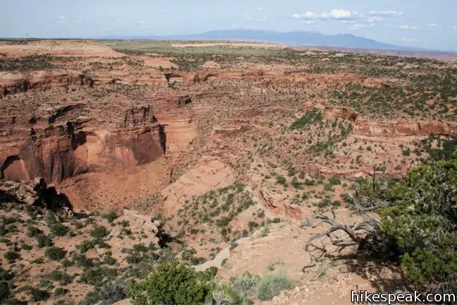
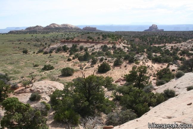
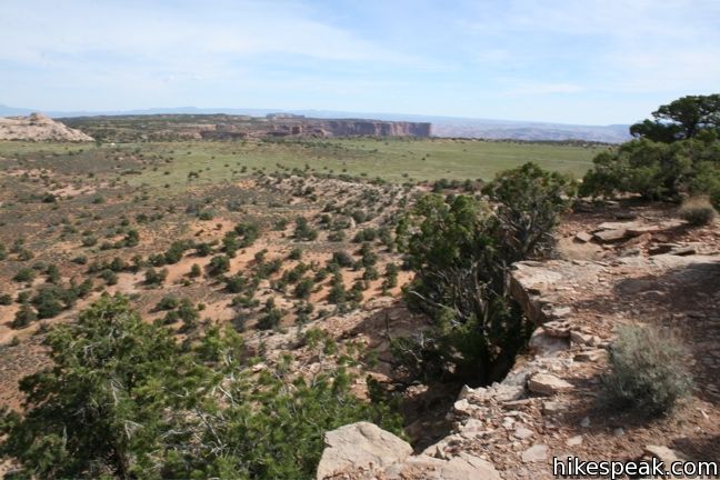
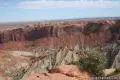
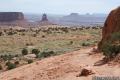
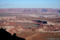
The faint track forms a loop. You may continue straight ahead to the north, or head to the right around the rim’s edge. Drop just of the northeastern rim to visit a pair of granaries built into sandstone alcoves. As you complete the loop, enjoy the great views into Taylor Canyon.
This 1.3 to 1.8 mile-hike has 250 feet of elevation change. The varied trail makes Aztec Butte one of the more rewarding hikes in the Island in the Sky. For a nearby hike with a more gradual ascent, take a trek up Whale Rock.
To get to the trailhead: From the Island in the Sky Visitor Center, drive south for 6.5 miles. After passing the Mesa Arch turnoff, turn right onto Upheaval Dome Road and drive 0.8 miles to the parking area for Aztec Butte on the right side of the road.
Trailhead address: Upheaval Dome Road, Canyonlands National Park, Moab, UT 84532
Trailhead coordinates: 38.39345, -109.88205 (38° 23′ 36.4″N 109° 52′ 55.4″W)
View Canyonlands National Park in a larger map
Or view a regional map of surrounding Utah trails and campgrounds.


 | Mesa Arch This 0.7-mile loop visits a picturesque arch spanning across the mesa's edge. |
 | Upheaval Dome This 1.7-mile hike visits two overlooks along the rim of a puzzling three-mile wide crater. |
 | Whale Rock This one-mile hike ascends a whale-shaped sandstone formation near Upheaval Dome. |
 | More trails in Utah Explore other hikes in Canyonlands National Park and elsewhere. |
[…] trip today included a hike in Canyonlands National Park to Aztec Butte. This 2 mile trail only had an elevation gain of 225 feet but it was very steep and only Micheal, […]