In the Sierra Nevada Mountains, sometimes you have to hike a great distance to a great view, and sometimes you don’t. Panoramic Point is the latter. The outstanding overlook can be reached via a paved 0.5-mile round trip hike with one switchback. The views are worthy of the name, looking northeast over Kings Canyon and surrounding snowy peaks. The trailhead is just a couple miles from Grant Village in the Grant Grove Area of Kings Canyon National Park, making it an easy-to-reach trailhead for an easy hike to views that are easy on the eyes!
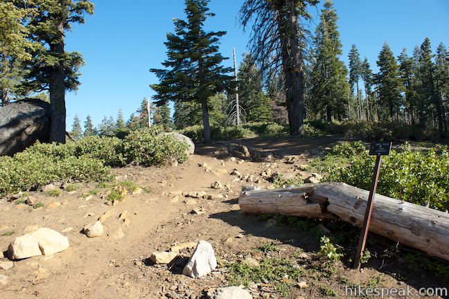
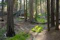
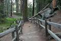
Start from the trailhead at the end of Panoramic Point Road, 2 miles up from the park visitor center and market at Grant Village. While the trail is paved, it does gain 100 feet in a quarter mile to reach Panoramic Point. There are no big views on the way to Panoramic Point as the pine trees along the trail don’t allow you to see very far. Halfway up to the viewpoint, the trail makes a sharp turn to the left, passing an awesome wood-carved bench.
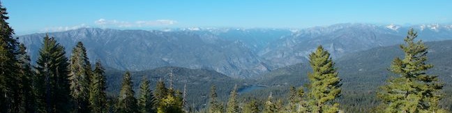
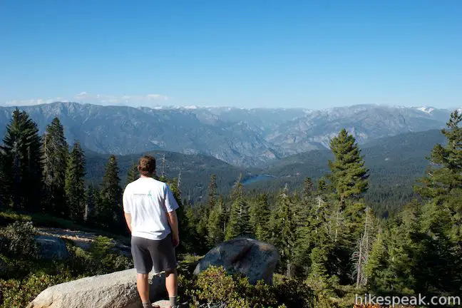
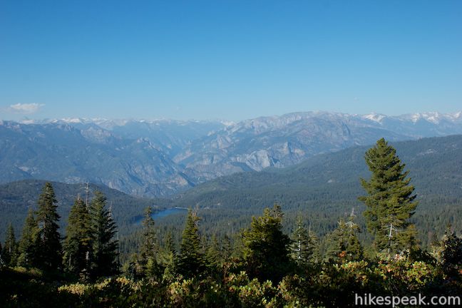
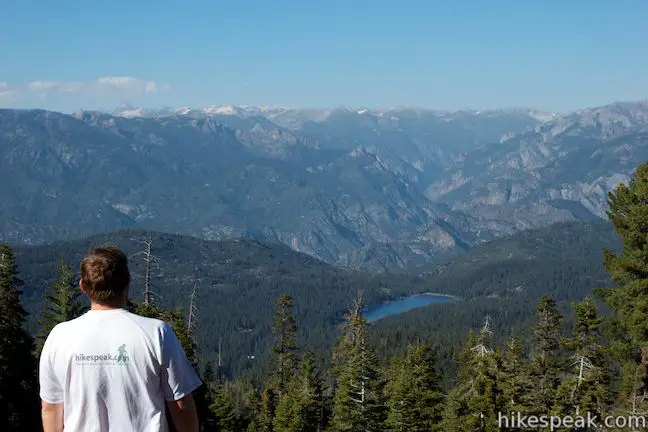
Before you break a sweat, you’ll arrive at Panoramic Point, elevation 7,520 feet, where the pavement ends and an enormous view opens up to the northeast. As if you could hike past it, an information panel marks the spot that reads:
Before you stretches the Sierra Nevada… the Snow Range. Geologists interpret the topography of the Sequoia and Kings Canyon Region – the high mountains and deep canyons, the rocks, the hills and valleys – as the result of forces operating over millions of years. Tremendous earth upheavals, erosion, the movement of ponderous glaciers and raging rivers, the winds and changing temperatures – all have had a part in sculpturing the vast region.
Ages ago, a huge block of the earth’s crust 40-80 miles wide and 430 miles long, was uplifted steeply on the east and gradually tilted westward in several major stages. The tilting increased downcutting of the rivers, which carves the canyons and defined the peaks. Alpine glaciers further outlined the sharp peaks and molded the canyons. Although reduced to only a fraction of their former size, glaciers continue to modify these mountains, adding beauty and adornment to the land. North Palisade Glacier, the park’s largest, lies behind North Palisade (34 miles distance on the Sierra Crest).
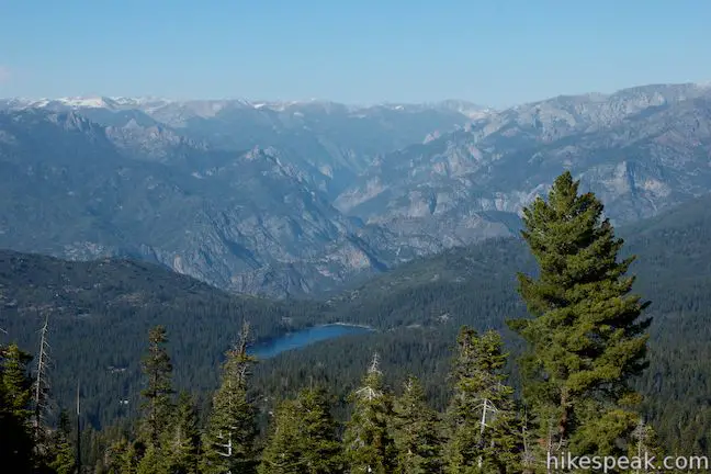
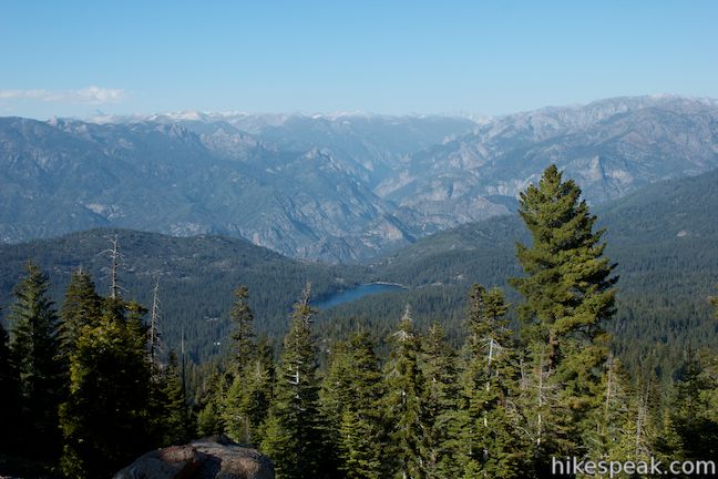
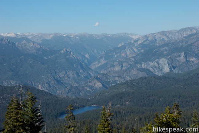
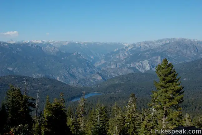
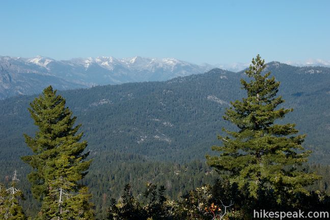
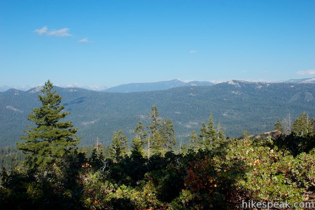
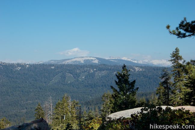
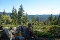
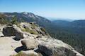
The panel also includes an impressive map highlighting the areas of Kings Canyon National Park and Sequoia National Forest that are visible from Panoramic Point (although it seems to shortchange the view to the east). So that you know what you’re looking at, the display features a drawing of the view with labeled landmarks. From left to right (west to east), the high peaks visible from Panoramic Point are Spanish Mountain (10,051 feet), the Obelisk (9,700 feet), Mount McGee (12,969 feet), Mount Goddard (12,568 feet), Kettle Dome (9,446 feet), North Palisade (14,242 feet), and Eagle Peak (9645 feet). In front of the snowcapped summits, there seems to be a countless number of interesting rock features along the sheer walls of Kings Canyon, including a dramatic string of spires along Tombstone Ridge on the west side of the canyon. In the foreground, Hume Lake looks alluring, cradled in a pine-covered valley, 2,300 feet below. Other snowy summits are in the distance to the east. More immediately you’ll see ridges covered in pine trees with a few bald patches where past landslides are evident.
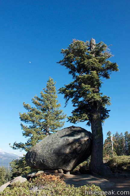
There’s no doubt you will be happy to linger at Panoramic Point. Below the point, a mountainside of boulders and manzanita trees provide open views above a line of pine trees. There aren’t any picnic tables, but there are plenty of rocks to sit on, and this would be a great place for a picnic. At the end of the day, while the sun is setting out of sight to the west, this perspective into Kings Canyon should burst with color.
Beyond Panoramic Point, Park Ridge Trail (unpaved) continues south, heading higher up the ridge to reach Park Ridge Fire Lookout Tower after another 2.4 miles. When you have enjoyed Panoramic Point, you can simply return the way you came for a short but memorable 0.5-mile hike.
A bathroom is located on the far side of the parking lot from the trailhead. The roads to Panoramic Point may not be plowed in the winter, so check in advance before visiting. Dogs and mountain bikes are prohibited on trails in Kings Canyon National Park. A national park entrance fee is required to visit Kings Canyon National Park, but you will not need a permit to hike to Panoramic Point, so get out and enjoy!
To get to the trailhead: From Fresno, drive east on Route 180. After some 50 miles, you will reach the Big Stump Entrance Station for Kings Canyon National Park. Proceed 1.7 miles to a three-way intersection. To the right, Route 198 heads south toward Sequoia National Park. Turn left to stay on Route 180 and drive another 1.4 miles north to Grant Village, on the right. Turn right, and drive east through the parking lot outside the park visitor center. Keep driving onto the road that continues out the far side of the parking lot. The road bends to the left along a meadow, curves right past Muir Lodge, and continues up a pine-covered ridge. At 2 miles from Generals Highway, the road comes to an end at the trailhead for Panoramic Point.
Trailhead address: Panoramic Point Road, Kings Canyon National Park, CA 93628
Trailhead coordinates: 36.753793, -118.946754 (36° 45′ 13.65″N 118° 56′ 48.31″W)
You may also view a regional map of surrounding Sierra Nevada trails and campgrounds.


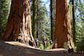
 | General Grant Tree Trail This 0-8 mile loop in the Grant Grove passes through a Fallen Monarch to reach the General Grant Tree, one of the world's largest sequoias. |
 | North Boundary Trail This 3.55-mile hike starts on the trail between Grant Grove and Grant Village and passes the General Grant Tree to reach a 2.75-mile loop through the pine forest north of the Grant Grove. |
 | North Grove Trail This 2-mile loop explores a quiet grove of sequoias near the crowded Grant Grove and can combine with Dead Giant Loop Trail for 3.25-mile hike. |
 | Dead Giant Loop Trail This 2.25-mile loop passes a small meadow and a large dead sequoia to reach Sequoia Lake Overlook and can combine with nearby North Grove Trail for 3.25-mile hike. |
 | Grant Village to Grant Grove Trail This mile-long trail connects the visitor center at Grant Village with the parking lot at Grant Grove, passing through Azalea Campground to reach giant sequoias, including the General Grant Tree. |
 | Buena Vista Peak This 2-mile round trip hike ascends 420 feet to a granite summit with 360-degree views over the Redwood Mountain Sequoia Grove and Kings Canyon. |
 | Hart Tree and Fallen Goliath Loop This 8.3-mile loop on Hart Tree Trail and Redwood Creek Trail passes tranquil streams and interesting sequoias in the Redwood Mountain Grove in Kings Canyon National Park. |
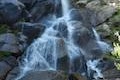 | Grizzly Falls This 0.1-mile round trip stroll at Grizzly Falls Picnic Area in Sequoia National Forest reaches the base of an 80-foot waterfall along the Generals Highway near the Cedar Grove Area of Kings Canyon National Park. |
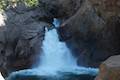 | Roaring River Falls This paved 0.3-mile round trip hike reaches a thundering little waterfall on a tributary of the Kings River in Kings Canyon National Park. |
 | Kanawyer Loop Trail This 5-mile loop is scenic and easy, exploring east from the backcountry gateway at Road's End along both sides of the South Fork Kings River in Kings Canyon. |
 | More trails in the Sierra Nevada Mountains Explore other destinations in Kings Canyon National Park and the rest of the range. |
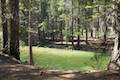
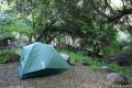 | Sequoia and Kings Canyon National Parks Campgrounds There are 14 campgrounds with over 1,000 total sites spread throughout the parks to facilitate your visit. |
Go the extra miles...
Submit a rating of this hike to go with your comment. Contribute to the average trail rating.