On the Sonoma County coast north of San Francisco, you will find an exceptional stretch of waterfront going under the name Salt Point State Park. This 6,000-acre park includes a marine reserve that is popular with divers and great oceanfront trails for hikers. The 3-mile round trip Salt Point Trail is level with nonstop views. It crosses grassy bluffs along a jagged shoreline to deliver a classic NorCal hiking experience.
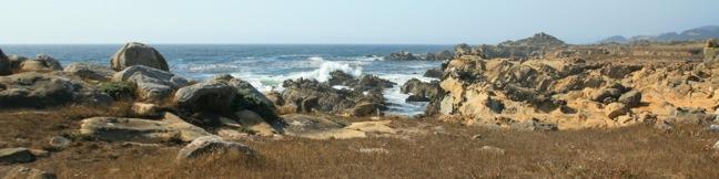
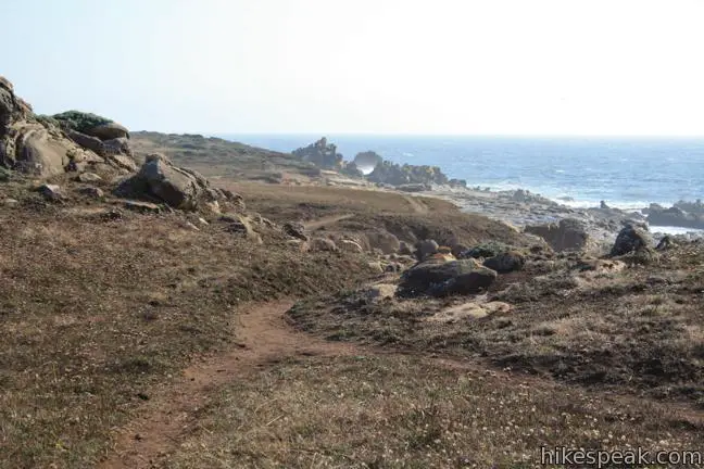
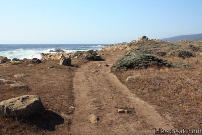
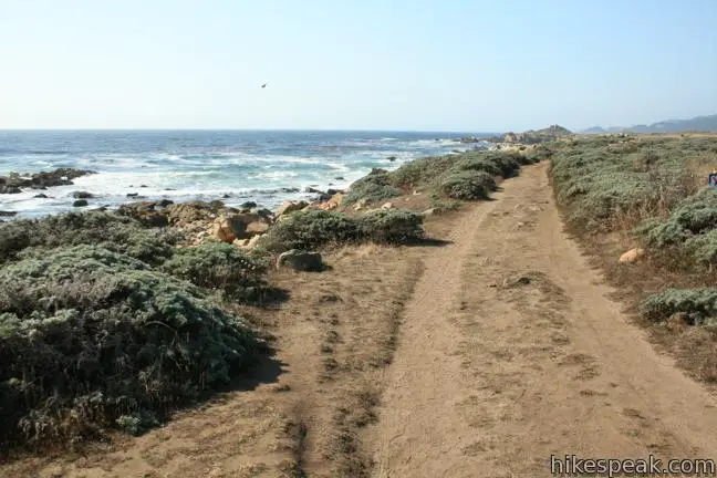
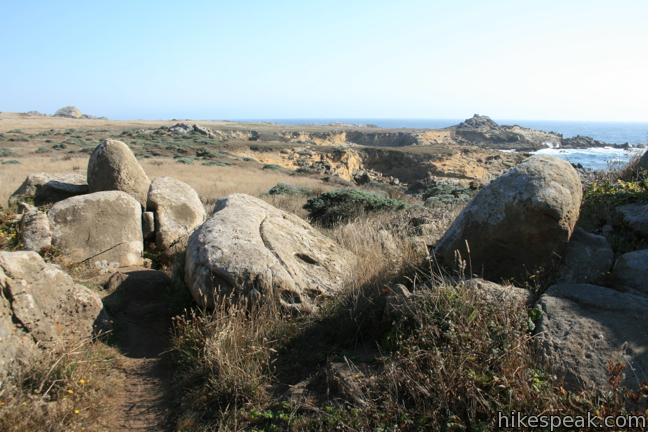
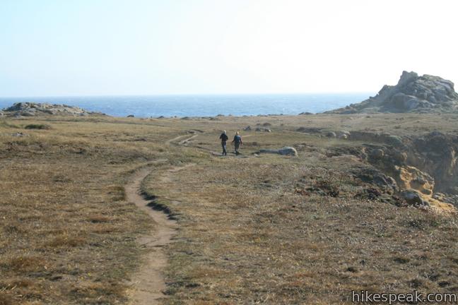
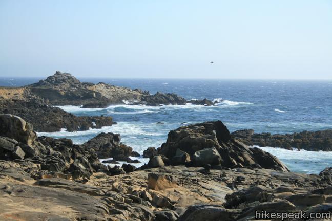
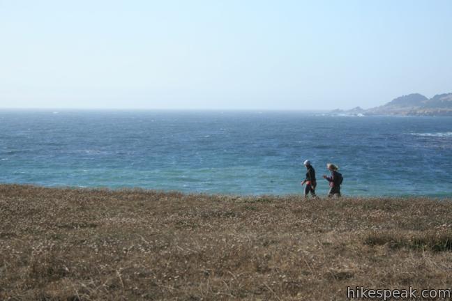
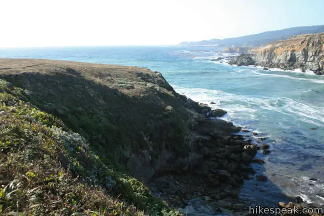
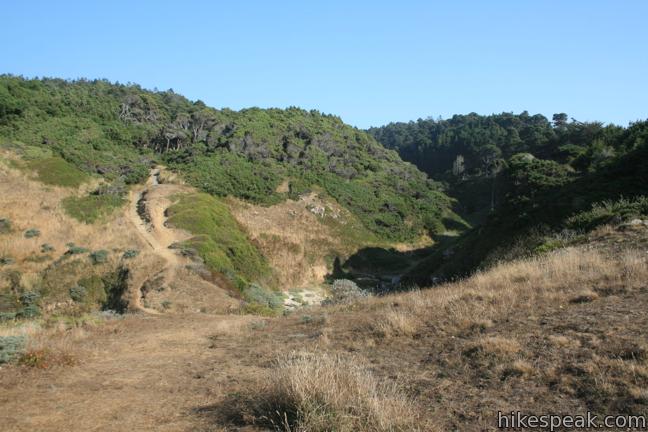
From the Gerstle Cove parking area near the Salt Point Visitor Center, hike toward the sea on the well marked Salt Point Trail. The path is paved for the first 750 feet. When the pavements end, you have the opportunity to step down to a cobblestone beach, or swing right and continue up the trail along the coast. The double-track jeep trail runs north over rolling grassland accented by bulging boulder piles, while a string of complimentary footpaths running parallel to the main trail allow a more intimate exploration of the coast. With little fear of getting lost, all routes are acceptable. There is only 50 feet of elevation change between the low and high points of this trail, so you wont get tired as you admire the dramatic waterfront.
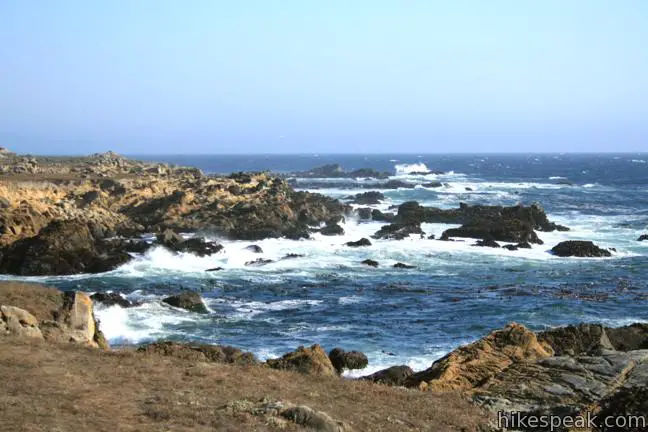
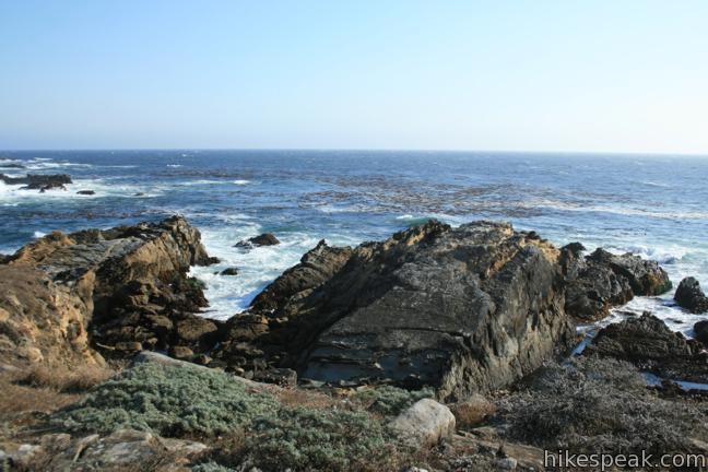
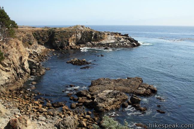
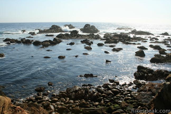
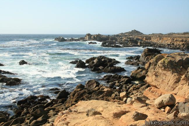
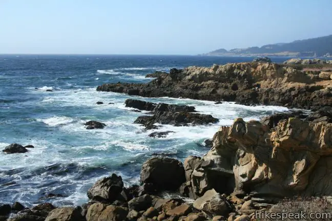
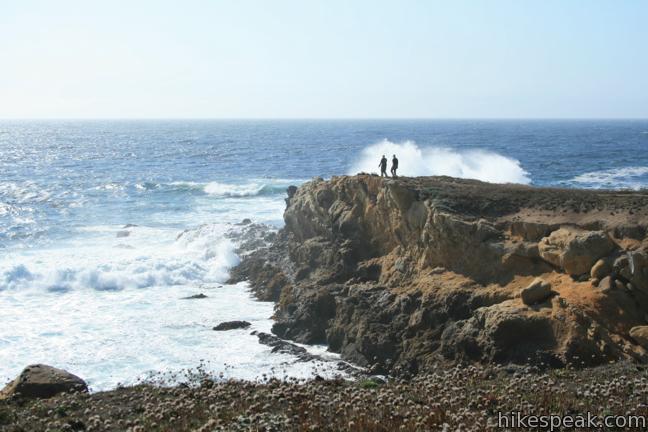
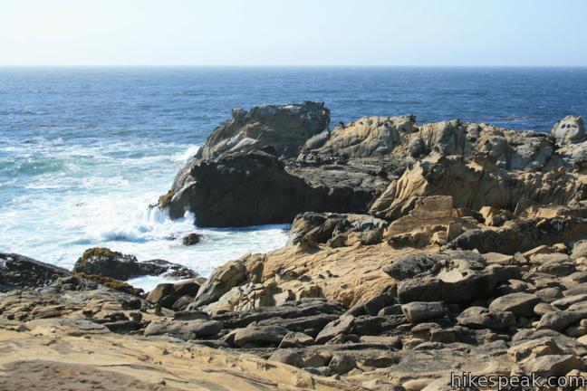
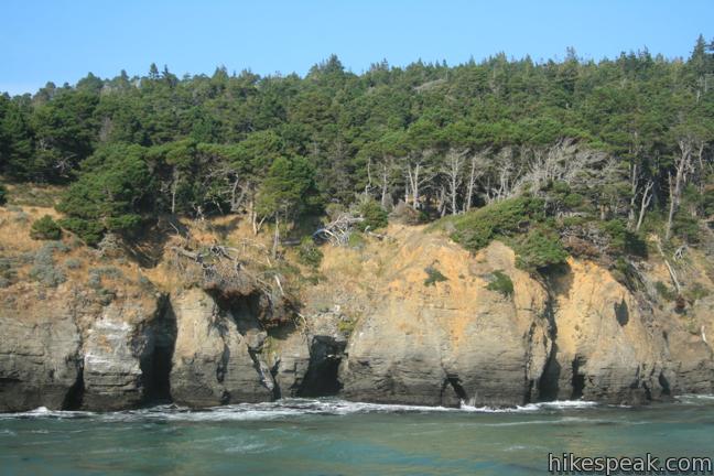
Crashing surf and gusting winds add excitement to the hike. Spring visitors will find poppies and lupines blooming amongst the coastal grasses, and the rugged rocks and deep blue ocean waters are mesmerizing year round. The top of the thriving bull kelp forest is visible just beyond the pounding waves.
Be sure to examine the sandstone just above the waterline where you will spot tafoni, unique boxwork-like formations common on Salt Point. The sandstone of Salt Point actually served as the building blocks for San Francisco structures and streets in the mid-1800s when Salt Point was tapped for its sandstone and lumber.
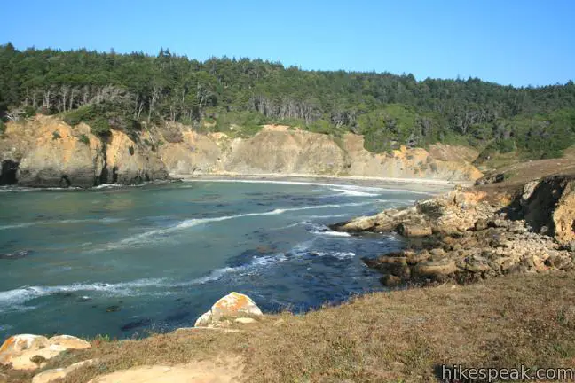
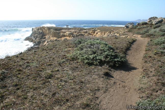
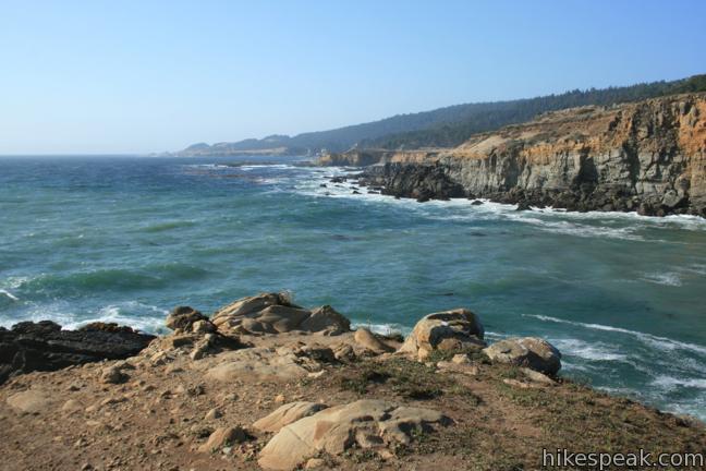
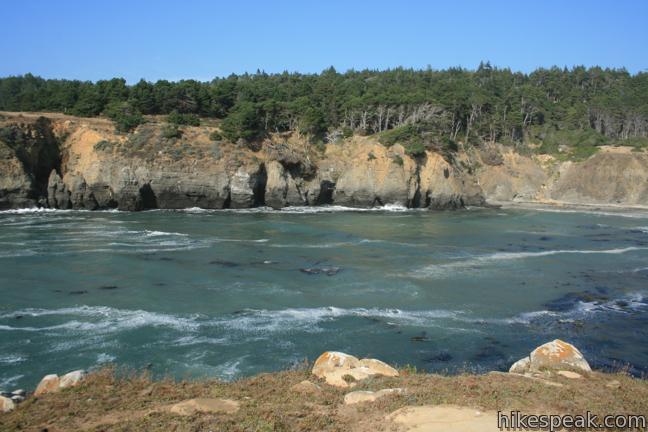
The erratic coastline eventually conforms into a large circular cove. As the trail rounds a bluff south of Stump Beach Cove, you will be presented long views up the Pacific toward the vanishing horizon to the north. Highway One runs just beyond the cliffs on the far side of the cove, but you won’t see or hear it from here.
If you want to feel the sand between your toes, take the short steep descent off the bluff to reach the cove and the bottom of Stump Beach Trail, which runs inland across Highway One. Otherwise, if you’d like a second look at the Salt Point shoreline (and why wouldn’t you?), this is an excellent place to turn around.
If you favor the jeep trail over the coast hugging footpaths on the return, you might cut out the very start of the trail following an adjoining trail to an alternate trailhead on the road just outside the parking area. If this happens, there will only be a few hundred feet to walk to reach your vehicle.
Travelers on Highway One longing for a closer look at the coast will love this three mile hike. Nice campgrounds are set back from the ocean for those who would like to stay longer, along with several other trails. Dogs are not allowed on Salt Point Trail. Salt Point State Park has a $8 day use fee for vehicles entering the park (as of March 2017). No permit is required to hike Salt Point Trail.
To get to the trailhead: From Highway One, 33 miles south of Point Arena and seven miles north of Fort Ross, turn west into the Salt Point State Park entrance for Gerstle Cove. Pass through the entrance gate and take the main park road to the Gerstle Cove parking area just past the park visitor center. The trail begins from the southwest corner of the parking area.
Trailhead address: 23476 Shoreline Highway (Highway One), Salt Point State Park, Jenner, CA 95450
Trailhead coordinates: 38.566688, -123.331852 (38° 34′ 00.07″N 123° 19′ 54.66″W)
You may also view a regional map of surrounding Northern California trails and campgrounds.


 | Laguna Point Boardwalk This 0.6-mile boardwalk provides an easy oceanfront hike in MacKerricher State Park. |
 | Durphy Creek Trail - Tan Oak Springs Trail - Lookout Point Loop This 3.75-mile loop climbs 1,000 feet to a forest ridge before descending to Lookout Point, where you can enjoy an unimpressive view to the south. |
 | Woodland Trail This 1.25-mile loop explores patches of redwoods surrounded by a shaded oak forest in Richardson Grove Redwoods State Park. |
 | Gould Grove Trail This half mile loop explores an old growth redwood forest across from the visitor center in Humboldt Redwoods State Park. |
 | Founders Grove Nature Trail This 0.5 mile loop explores an ancient grove honoring the founders of the Save-the-Redwoods League in Humboldt Redwoods State Park. |
 | Fern Canyon Trail This one-mile hike explores an incredibly ferny canyon in Prairie Creek Redwoods State Park. |
 | Stout Memorial Grove This 0.55-mile hike explores an old growth grove of coastal redwoods in Jedediah Smith Redwoods State Park. |
 | More hikes in Northern California Explore other trails in Northern California, including hikes around Mount Shasta. |
 | Jade Cove and Plaskett Rock Point in Big Sur This 1.5-mile hike along an ocean bluff visits a prominent peninsula and a small cove. |
 | Bluff Trail in Montaña de Oro State Park This hike of around three miles tours tide pools, beaches, and impressive cliffs along a picturesque coastline. |
 | Point Buchon Trail in Montaña de Oro State Park This 1 1/3 to 6.8-mile hike explores the beautiful coastline south of Montaña de Oro State Park. |
[…] Salt Point is filled with scenic hikes that deliver a true Northern California coastal experience, and the Salt Point Trail remains true to that California-cool vibe. You’ll have the opportunity to see wildflowers, vibrant sandstone formations, and, of course, the deep blue ocean. […]
Do you need to reserve a campsite along the trails or just camp anywhere you like and what is the cost to use overnight parking.
The campgrounds at Salt Point State Park do accept reservations. You can find more information on the park’s official website and camping brochure.